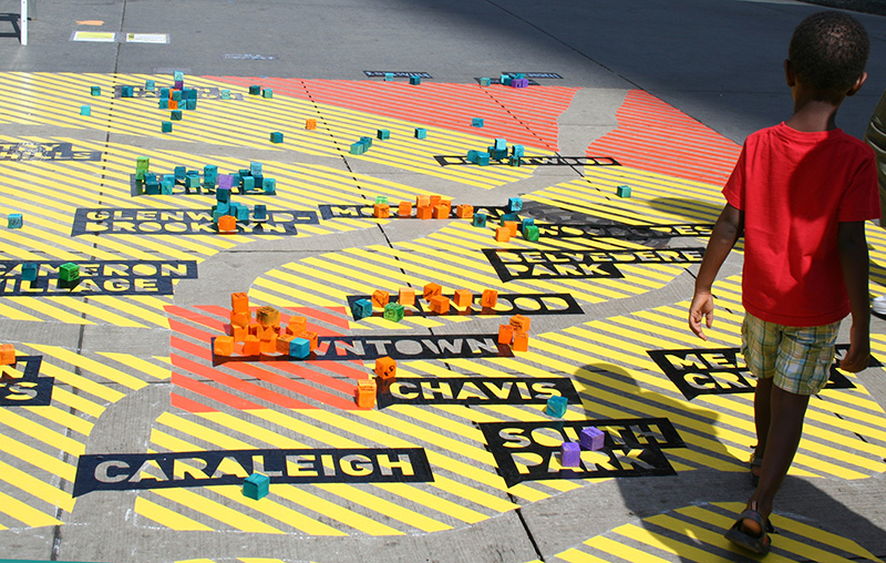
Through a collaborative, faculty-led initiative, my work with Co/Lab engages in projects where mapping and data visualization are used as a tool for gaining insight into complex issues of urban development and community. Our projects fall into one of the following categories:
- Participatory Mapping: We have created a number of large-scale public mapping projects that act as survey instruments in conjunction with events and other projects.
- Online Cartographic Tools: We have created a number of cartographic tools that visualize and map relationships among social, academic and professional networks.
Mapping movement | AIA Workshop | Raleigh, NC | 2014
Co/lab was asked to create a participatory installation that would illuminate the ways that people move through the city of Raleigh, NC. As a city amidst great transformation, we decided to focus on movement, with specific comparison to where existing and future infrastructural developments existed (or where planned.) The goal of this juxtaposition was to compare residents needs with urban planners proposal to see where alignment and gaps existed.
Spark Con | Raleigh, NC | 2012-2014
Co/Lab has worked with the Downtown Raleigh Festival, SparkCon, to create a series of participatory mapping installations that collect and display information, ideas and concepts on a range of topics from public/private transportation, public space, and personal histories. Through these large scale installations, participant are able to contribute to a growing real-time survey of ideas on the past, present and future of urban development. My role specifically focused on conceptual development, graphic representation, and documenting and coding data collected.


